
FURUNO
24" Display ECDIS
FMD-3100
MERCHANT MARINE
Display Size
24 inches
Display Type
Color LCD
Chart Type
Raster or Vector or C-Map Professional Plus
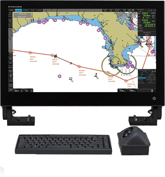
The FMD-3100 is an IMO-compliant ECDIS featuring a 24" display. It facilitates a smooth transition from paper to electronic navigation with precise route planning tools This advanced system enhances maritime safety through seamless chart integration. It is the ultimate solution for professional vessels requiring efficient and reliable navigation
Specifications
| Chart Type | Raster or Vector or C-Map Professional Plus |
| Display Size | 24 inches |
| Display Type | Color LCD |
| Power Supply | 110 or 220 VAC or 12/24 VDC |
Features & Functions
- Compliant with IACS UR E27
- 24" wide LCD (Full HD: 1920 x 1080 pixels)
- Streamlined integration into the onboard navigation system; perfectly suited for ECDIS retrofitting projects
- Suitable for both primary and back-up ECDIS.
- Easily interfaces with existing FAR-2xx7 series Radar for:
- Radar overlay
- Target track info
- Route and waypoint
- User Charts
- exchange via Ethernet
- *Software update on FAR-21x7/FAR-28x7 series might be necessary depending on the program number
- *For Radar overlay with analog Radar such as FAR-2xx5 series, the optional RCB-002 RadarConnection Box is required
- Complies with the following IMO and IEC regulations:
- IMO A.694(17), IMO MSC.191(79), IMO MSC.232(82), IMO MSC.302(87), IEC 60945 Ed. 4, IEC 61162-1 Ed. 5, IEC 61162-2 Ed. 1, IEC 61162-450 Ed. 2, IEC 61174 Ed. 4, IEC 62288 Ed. 2, IEC 62923-1/-2
- Instantaneous chart redraw delivered by FURUNO’s advanced chart drawing engine, making redraw latency a thing of the past
- Task-based operation realized by combination of Status bar and InstantAccess bar™ providing quick access to the needed tasks/functions
- Compatible cartography
- IHO/S-57 Edition 3 vector chart (IHO S-63 data protection scheme)
- ARCS raster chart
- C-MAP Professional+* *C-MAP Professional+ is a private chart, hence not construed as replacement for paper chart
- Compatibility with Admiralty Information Overlay (AIO) for further navigation safety